GPS trackingWe’ll help you keep your vehicle fleet and the fleet-related expenditure under control
Our Customer Stories
Metrotec’s digital solutions help transport companies save time and money
Melka Auto is an Estonian family-owned company operating both in the domestic market and across Scandinavia. We spoke with Meelis Jürgenson, logistics manager and managing director at Melka Auto, about his experience using Metrotec’s GPS tracking software. He explains how the solution has made their daily work more efficient, transparent, and easier to manage.
What are your main work processes, and what types of transport services do you provide?
With our dump trucks, we transport bulk materials. With curtain-side trailers, we carry essentially everything else that our clients need transported. We also use sea containers to move clients’ goods to and from the ports of Paldiski and Muuga. The range of goods we transport is broad, from construction materials to food products.
What does a typical working day look like, and what kinds of problems do you need to solve daily?
A typical working day often starts with a load unloaded abroad, after which I hand over the CMR to the local logistics coordinator. Once the coordinator sees… Continue reading
Aspen Group: Metrotec helps prevent fuel theft
Fuel theft is a daily headache for heavy equipment companies. Insurance doesn’t cover it, handling cases is time-consuming, and often there are no results. We have mitigated this business risk by monitoring fuel levels. While it doesn’t provide 100% protection, it is quite effective and allows for quick response in case of danger, helping prevent the worst. Aspen Group CEO Kaidar Erik and employee Kerli Ruubel share their thoughts.
What happens when fuel theft occurs?
Our machines are equipped with GPS tracking and level sensors. If the fuel level drops suddenly, an automatic alert is sent via email and SMS… Continue reading
F-Track web interface
Positioning
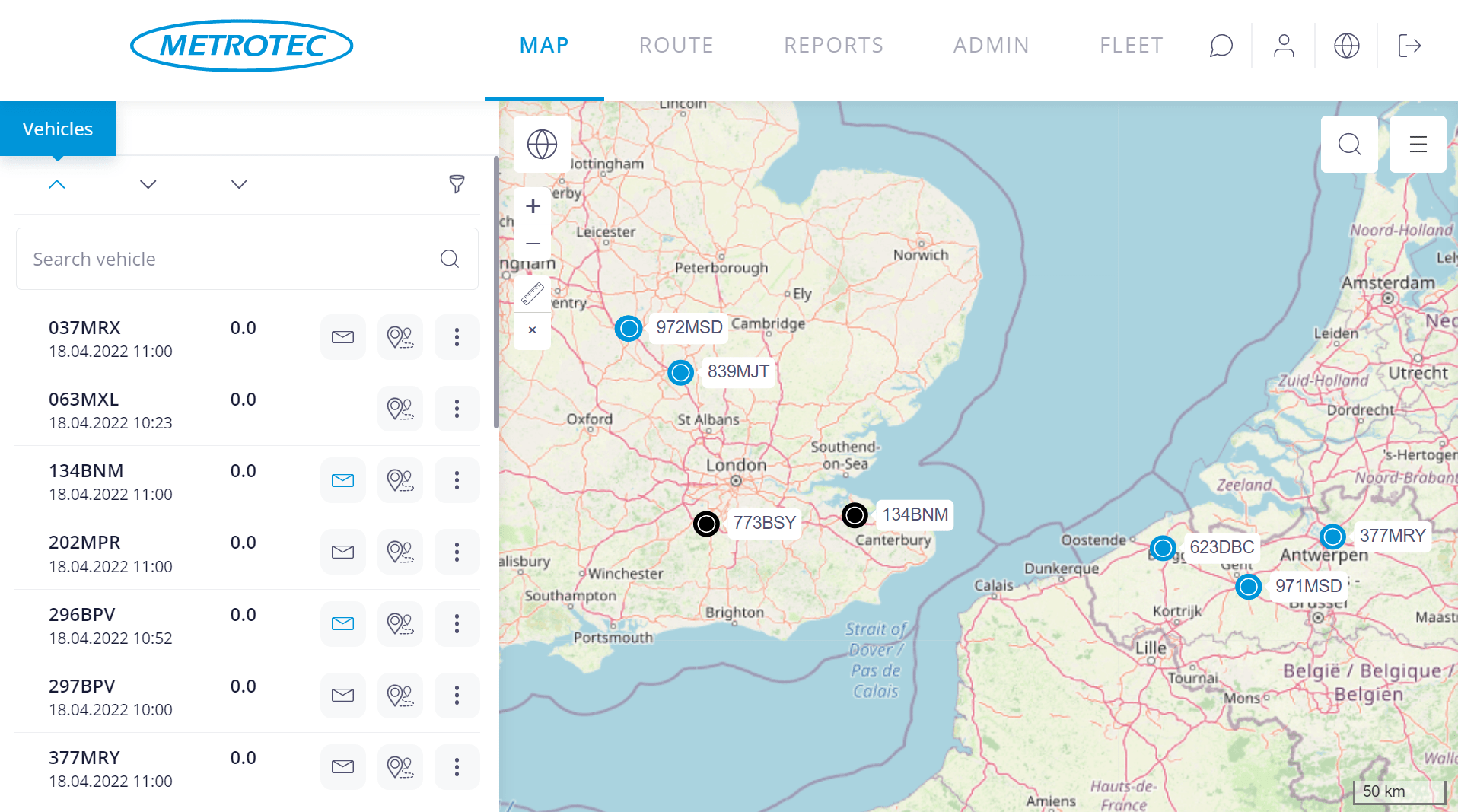
- Continuous realtime info about location and tasks of vehicles
- Different base maps
- Searching the map
- Creating and managing POI’s
- Playback a route
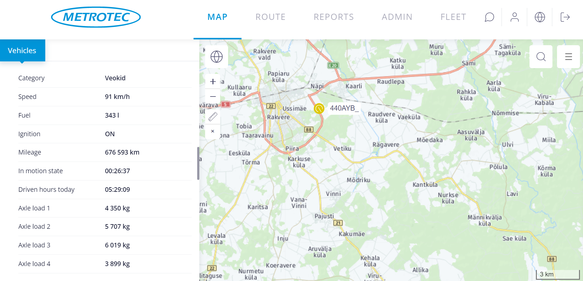
Clear overview of the fleet – moving and standing, working and idle vehicles. Were the chosen route and speed optimal? How long it took to load a cargo? A route displayed on map provides exact answer. Even better – use playback and follow the route.
Two-way communication with drivers
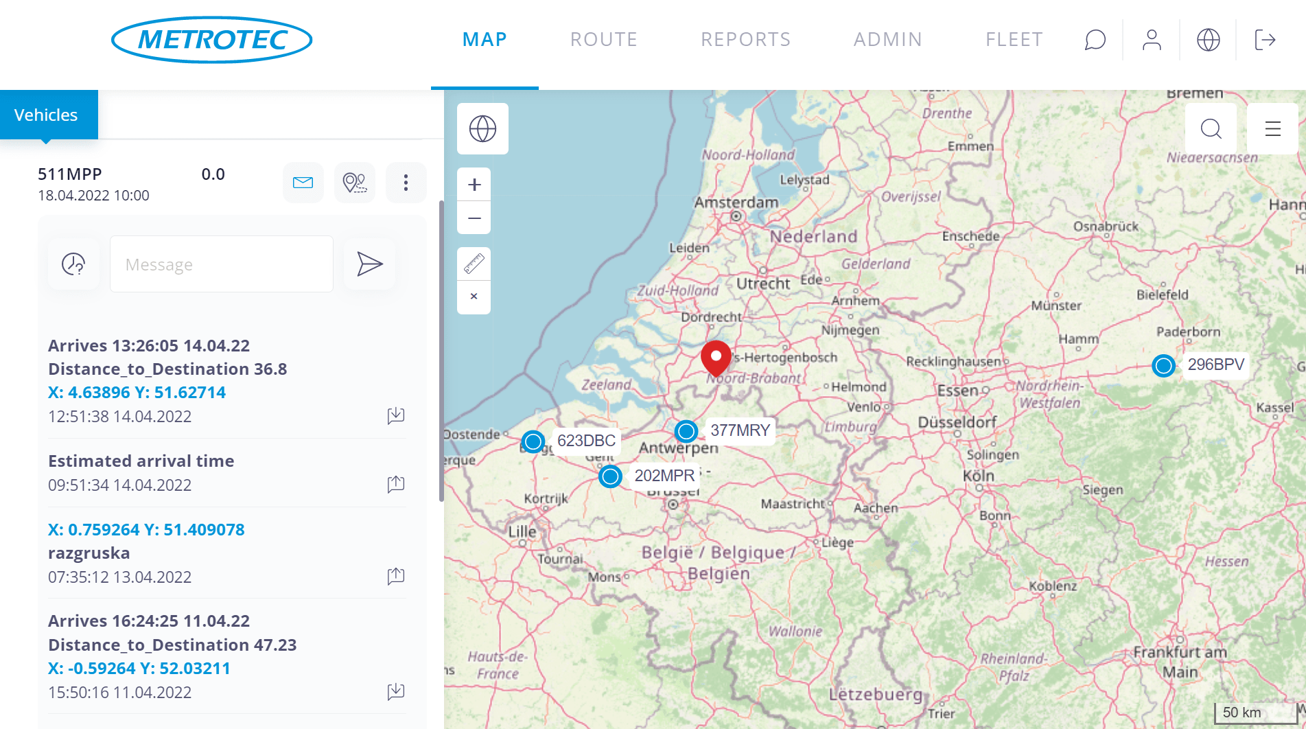
Garmin’s navigator, assigning tasks and destinations, estimated time of arrival .. Remotely controlled navigation terminal near drivers seat creates two-way data exchange between office and driver, including map support.
A destination marker (POI) on a map in office is transferred with a mouseclick to the drivers navigation terminal. Maximal understanding through minimal effort! The driver accepts the task, navigation device guides the driver. The office sees, in addition to vehicles location and busyness, destination data and Estimated Time of Arrival. The yourney can be observed in real time. Precisely determined destinations save time and fuel. A task specified on map combined with navigation terminals directions makes drivers work simple and stress-free. In addition to automated messages, the navigation terminal enables two-way communication between office and driver. Simple and fast communication increases flexibility in reacting to events – from an unexpected job to a broken tire.
Booking
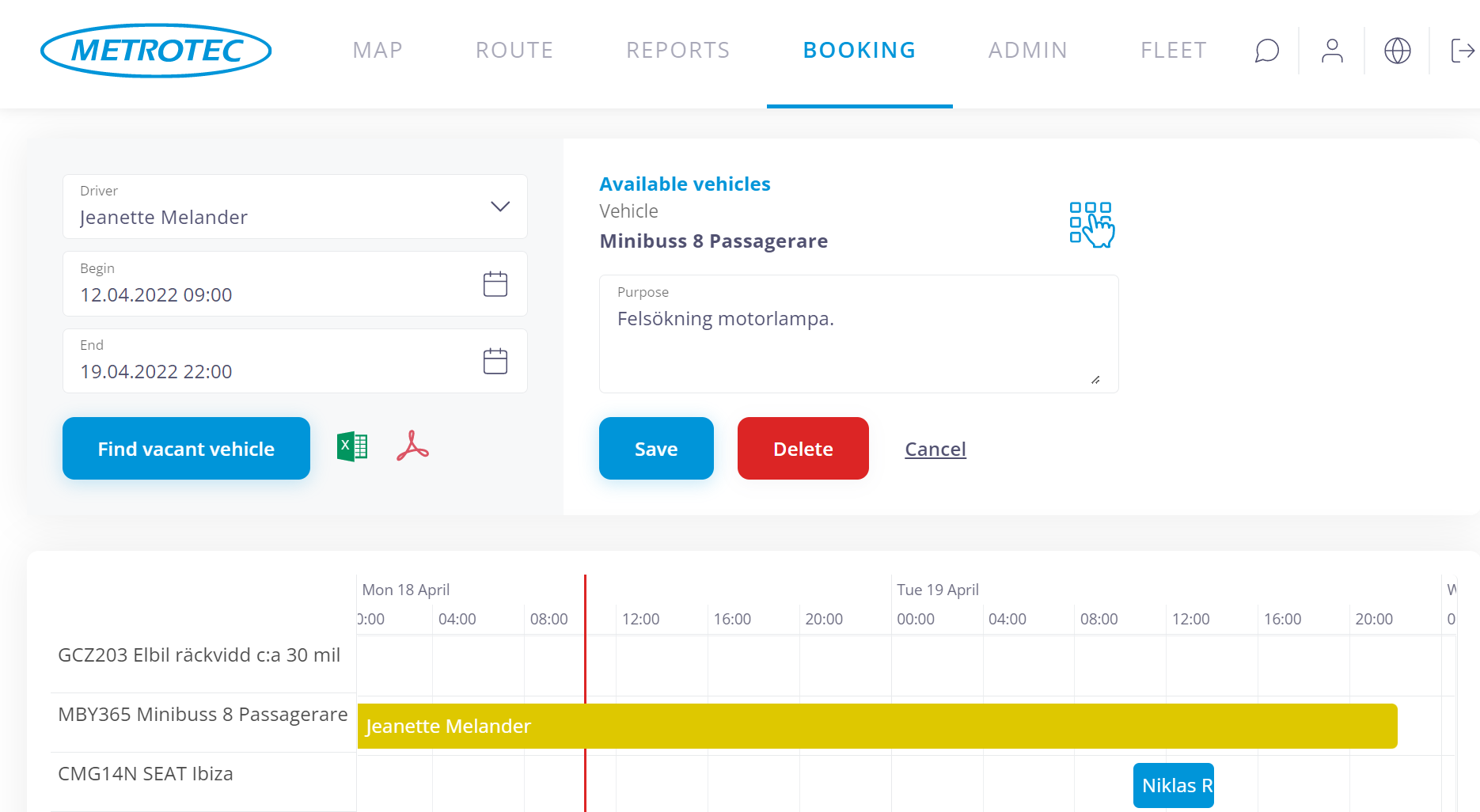
- Joint use of vehicles
- Booking of a vehicle for a certain driver for a certain, determined period
- Opening of the central locking from the driver’s phone during the period of the booking
Joint use is one of the options for optimization of the size of the vehicle fleet. The booking system allows the user to book a vehicle for an upcoming period and provides a good overview of the general use of the jointly used resource. Depending on the application of the device, the central locking and alarm system can be controlled from the user’s mobile phone during the period of the booking.
Graphs, tables, charts
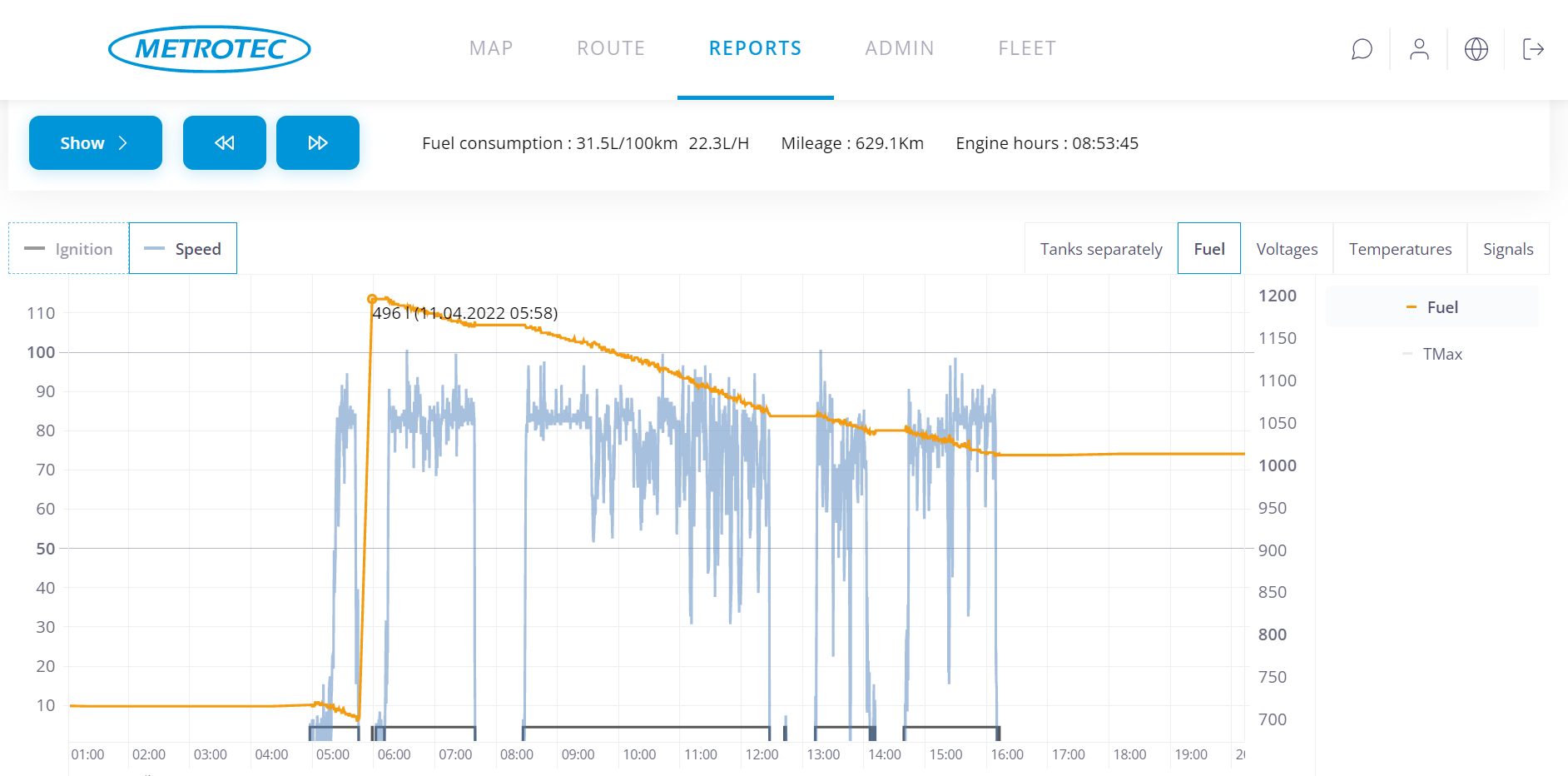
Data is presented in comparative tables to increase clarity. Sort vehicles by fuel consumption, mileage or any other meter.
A data presented as chart or graph obtains a new level of clearance. A moment explains what happens in vehicles fuel tank. Dynamic scale will present clearly a minuscule fuel loss.
Reporting

F-Track system produces continuous high quality data stream by registring periodically readings from connected sensors, detecting changes in the readings and storing 24/7 movement history.
Processing, filtering and concentrating this data provides users with different reports. The reports reflect driving, waiting and idle periods, work and rest time and movement speed as well as mileage, refueling, average fuel consumption per mileage and working hour. Interactive user interface enables odometer based task diary. User may export reports as needed in html, pdf, csv or xls formats.
Data from vehicles computer
Acceleration, deceleration, use of cruise control, tachometer readings – they are all variables in the equatation of average fuel consumption.
Everybody is trying to make sure, that fleet is exploited correctly and sustainably. Readings from on-board computer allow to appraise driving habits and proper maintenance.
Data export

F-Track system produces precise and reliable data. It is suitable for analysing business processes as well as payroll calculations. The data of F-Track system is compatible with value management software and accounting programs.
F-Track API is a convenient tool for integrating with another info system. Formulate a query and “mine” quality data directly from our database be it working hours, mileage or something else. A little low level programming work and entire import is automatic and “tailor made”.
Alerting
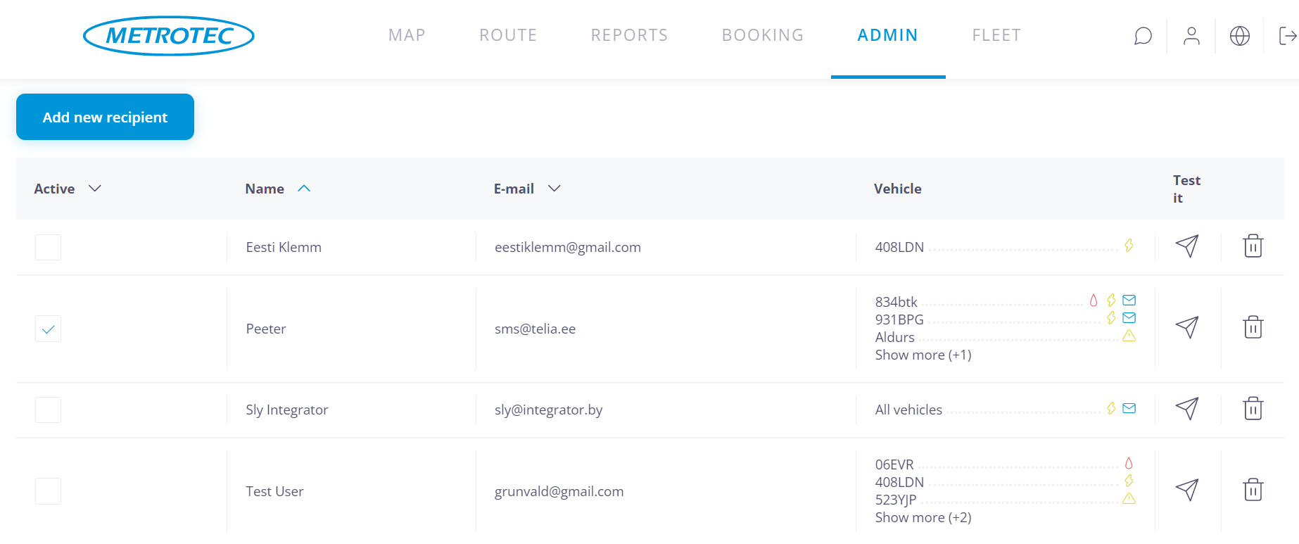
It is important to be operatively informed about problems. Most popular alarm is currently SMS message indicating fuel loss. Operative reaction has often disturbed fuel thieves, occasionally allowing to capture them.
Also, it is important to stay on the right side of law – be it insurance, routine maintenance or mandatory resting hours. Alerting system allows to divide events into different categories and to inform directly respective responsible persons. The number of receivers is unlimited and different receivers can be assigned to individual vehicles, so that every E-mail and SMS reaches correct person – be it security alert, fuel loss, servise message or important message from driver.
Users with different privileges
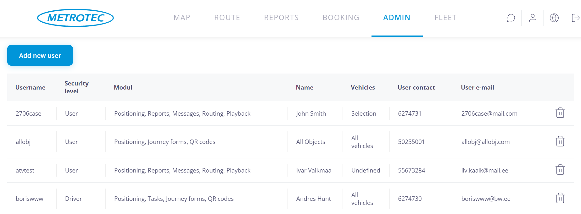
By creating and administering user accounts you can provide workers, business parners, clients, etc. with different levels of access to the data of F-Track system.
Somebody wants a certain report about certain vehicle. Somebody wants to track a cargo. Somebody wants to see exact hours they were billed for. Flexible system of sub-accounts with different profiles and privileges combined with tying different users to different vehicles allows for taylor made customisation of access to data.
Geoareas
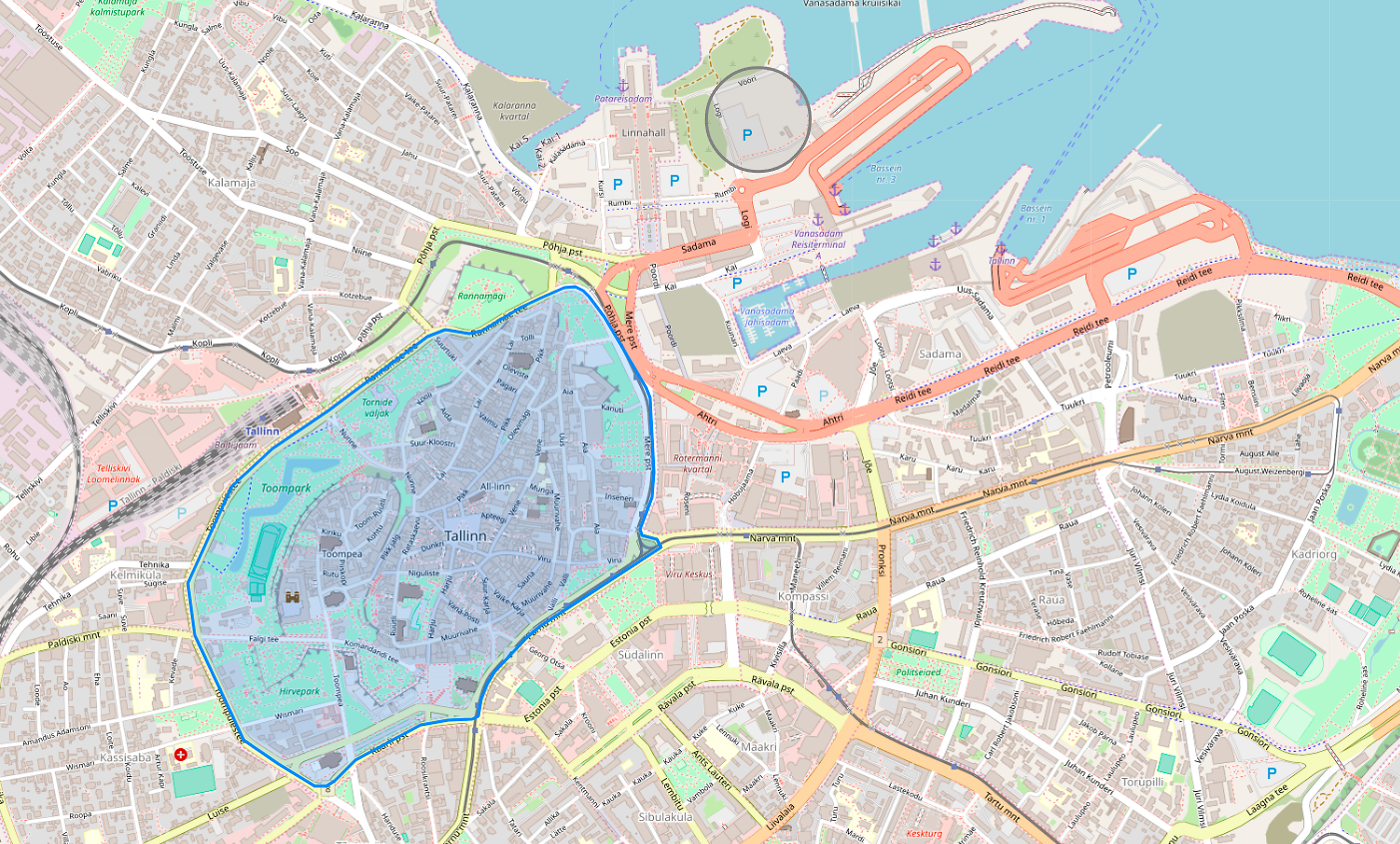
- Polygonal or circular
- Visitation reports based on areas, points of interest, or countries
- Assembly notification in the event of arrival of several objects in one area
Circular or polygonal areas can be used to mark loading and unloading locations, mineral deposits, fields, or any other different territories on the map. Visitation reports of areas enable to conveniently count loads, measure the time spent on removing snow, ploughing, or providing another service.
The user can request to be notified of a higher than required number of vehicles assembling in a certain area.
Work statuses

It has always been advised to use accurate measurement and analysis as the prerequisites for efficient expansion.
First, we should divide the work or service process into statuses.
The division and naming of the statuses as well as the number of different statuses vary in the case of each specific occasion.
Identification of drivers

- Measurement of the working time spent outside of the office
- Recording of working time in the case of shift work
- Use of special machinery by different operators
- Handy driver-based reporting
Accurate recording of working time and driver-based reporting are both important functions. Seasonal works are usually performed in several shifts. It is quite common that special machinery is used by several different drivers. The machines are equipped with readers, which register the drivers’ chips. The codes of the chips are associated with the drivers in the database in the server. It is possible to check any time who is currently driving and who has been using a certain vehicle in a previous period.
Measurement of temperatures
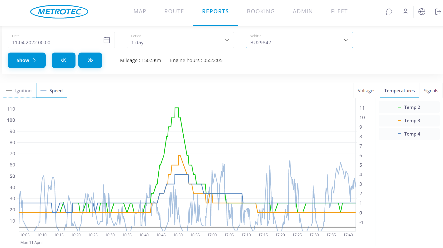
- Notification of detection of limit temperature
- Monitoring temperature in cargo space
- Use of up to 8 thermometers in one unit
- Temperature log for a customer of transport service
In several applications it is necessary to monitor temperature of the environment or to receive alarm upon detection of limit value of the temperature. Metrotec enables to use up to 8 thermometers with a single unit. Permissible total length of connection cables up to 40 m.
Diagrams show the dynamics of changes in the temperature during former data history. Data history indicates clearly, when a specific temperature was measured. Comparing it with the driving situation, location of the vehicle and data of on-board systems, it is possible to understand causes of any situations and mutually related circumstances.
Tachograph
- Automatic copying of the data of tachograph and driver’s card independently of the location of the driver and the vehicle
- Automatic archiving of data
- Web-based access to files
- Comprehensive reports of the operations, violations and mistakes of the driver
Notice of the event of copying of data in the tachograph
Proceeding from the law, the transporter is obliged to copy data from the tachograph once a quarter and from the driver’s card once a month. This task is well suitable for software. This removes the need to remember a bothersome obligation and spares time on account of performing of the operation. The user shall specify a period for each vehicle, upon expiration of which data are copied and archived automatically. Notice of downloading will also remain in the tachograph. Detailed reports are always available in the web.
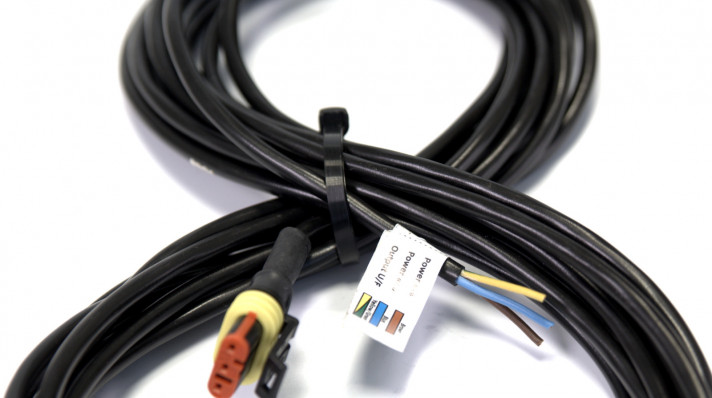
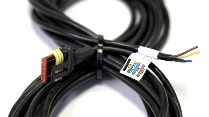
Devices

Adapter
The adapter is designed for calibration and setup of the sensor. It has a Windows user interface, USB 2.0 port and FTDI chipset.
Read more