GPS trackingWe’ll help you keep your vehicle fleet and the fleet-related expenditure under control
Customer testimonials
Read some of the real stories from our customers sharing how they have benefited from our GPS tracking solutions.
Learn about the innovative use of GPS tracking, the challenges this has resolved and the improvements that have been attained.
The journey to paperless and efficient logistics
Metrosystem OÜ is a company specializing in pallet repair and sales. We spoke with Villem Massur, Sales Manager at Metrosystem, about how Metrotec OÜ has helped them keep their work processes efficient and optimized.
When did your cooperation begin, and how did you find Metrotec?
“Our cooperation started around 2011. I can’t recall exactly who contacted whom first, but I remember bringing our first vehicle to Veerenni Street to have the devices installed. At that time, our fleet was expanding, and we needed real-time visibility of vehicle locations and movements.” Back then, several GPS tracking providers were under consideration, and meetings were held with different companies.
“In the end, we chose Metrotec because communication felt right and their support was professional and reliable.”
What has been the greatest value so far?
“Daily work has become significantly easier.” Continue reading
€4,000 saved on paper alone
We interviewed our long-term client AS Rudus, whose core business includes the sale and transport of ready-mix concrete, granite aggregates, and concrete products. Our interviewee was Kaido Kivistik, Production and Technical Manager at Rudus.
How did the cooperation with Metrotec begin?
There was uncertainty about fuel consumption and mileage, and doubts about whether routes were truly optimized.
“We drove the routes ourselves, recorded distances in Excel, mapped routes on paper, and compared mileage using map software. The workload was heavy, and disputes were frequent. GPS tracking seemed like a good control measure. That’s why we contacted Metrotec OÜ, and we’ve had no reason to regret it.”
With Metrotec, it became easy to monitor route accuracy and keep fuel and time costs under control. Drivers can see the route to their destination on a tablet and use it for navigation.
“In our daily work, we often serve high-frequency sites where we deliver hundreds of loads. Even saving a few kilometers per trip can lead to significant fuel savings over the course of a day or an entire construction project.”
What developments followed?
Today, we have fully switched to digital delivery notes and no longer use paper at all. And the benefits are clear… Continue reading
A mutually beneficial partnership
The goal of Tallinna Jäätmete Taaskasutuskeskus AS (AS TJT) is to provide efficient and innovative waste management solutions.
In cooperation with Metrotec OÜ, the company has made significant progress in improving the quality of its waste collection services.
Metrotec’s technological solutions enable AS TJT to monitor garbage truck movements in real time, optimize routes, manage vehicle maintenance, and track vehicle usage. This ensures a more environmentally friendly and cost-effective service, as well as better customer service.
The partnership also supports compliance with ESG requirements by providing accurate reporting on CO₂ emissions and fuel consumption.
With the help of Metrotec’s solutions, AS TJT has taken its waste collection service to a new level.
Jelena Filimonova
Marketing and Communications Manager
Tallinna Jäätmete Taaskasutuskeskus AS
The Practical Importance of Fuel Level Sensors
As is well known, fuel level sensors are an additional feature within GPS monitoring systems. Companies engaged in road transport often underestimate the added value that fuel level sensors can provide.
Naturally, in the context of logistics, a truck’s location is of primary importance, and a great deal depends on it. If, upon logging into the Metrotec portal in the morning, you discover that for whatever reason the vehicle’s progress has been less than planned, the logistics manager must make extra efforts to ensure that delivery schedules and contractual obligations are still met. This adds further pressure to an already heavy workload and high stress level, potentially leading to negative consequences for the company. In the worst-case scenario, it may even result in the customer terminating the transport contract.
The importance of fuel probes is not always fully understood. They are often seen merely as redundant tools for monitoring fuel consumption, duplicating measurements already available through standard tracking packages that come with the vehicle purchase. Fuel consumption data can also be viewed from the onboard computer. That is true — such monitoring is possible.ˇ
However, the real added value lies in security.
We have experienced this firsthand on several occasions. Along with installing fuel probes, we also equipped our vehicles with an alarm horn that arms automatically and activates whenever the fuel level drops.
The most recent incident occurred in Germany, in a public parking area alongside the highway — a place that could reasonably be considered safe. During the night, the driver was awakened by a deafening blast of the alarm horn, which could mean only one thing: thieves. And indeed, that was the case. The criminals were so startled by the sudden alarm that, as they fled toward the woods, they left behind all of their equipment.
The next morning began for our driver as usual — morning coffee, brushing his teeth, and the peace of mind that he would be able to continue his journey on time. This time, however, there was one difference. Returning from the restroom, he noticed the driver of the truck parked nearby marching angrily around his vehicle, shouting into his phone in despair. That man’s morning was far darker: his fuel tanks had been drained completely, and he now had no choice but to inform his logistics department of the situation.
I strongly recommend these devices. Their cost is insignificant compared to the value of the fuel being protected. Another important factor is the time saved — time that would otherwise be wasted dealing with someone else’s mess, a delay which, from the client’s perspective, cannot simply be blamed on force majeure.
Arvi Laht, Erste Transport

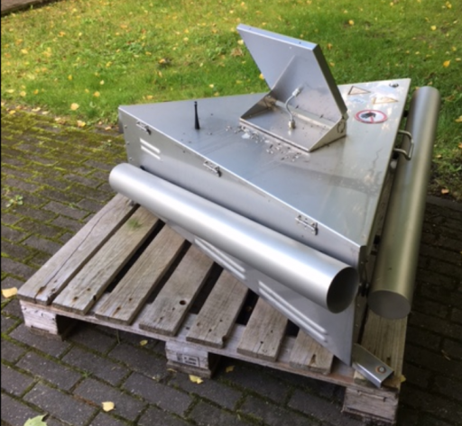
Bird control cannon
Tallinn Airport uses gas cannon for bird control. The cannon are now controlled through a map application. Since the airport’s territory is large and the cannon are located at considerable distances from one another, the earlier system of radio-link control ran into problems due to signal coverage limitations. A promising option to solve the problems was to use our GIS map application that shows cannon locations to also transmit control signals to the cannon. This would allow the entire process to be recorded and, where needed, replayed for airlines as well as for regulatory authorities inspecting the airport.
Metrotec also developed a tailor-made map application that showed the locations of our cannon, their operating status and also allowed firing control signals to be sent to them using smartphones regardless of our own location at the time. This made it possible to activate the cannon directly from the trackmaster’s vehicle whenever needed.
Metrotec also developed a tailor-made map application that showed the locations of our cannon, their operating status and also allowed firing control signals to be sent to them using smartphones regardless of our own location at the time. This made it possible to activate the cannon directly from the trackmaster’s vehicle whenever needed.
Our collaboration with Metrotec was smooth and effective because of their proactive and creative approach. We are happy to conclude that we’ve succeeded in developing a custom-made solution that has to date operated reliably for a number of years. We have also employed the solution at Tartu Airport, where the cannon, in addition to our own employees, can be operated by the air traffic controllers of Lennuliiklusteeninduse [Air Traffic Service] plc from their desks in the air traffic control tower.
Shared use of vehicles in Gotland
The shared use of vehicles constitutes a significant opportunity to optimize your company fleet. Regardless of whether the fleet amounts to 10 or 100 units, increased efficiency is guaranteed.
Goal: The region of Gotland aims to become fully sustainable by 2025. As a step towards this goal, Gotland announced a public tender to provide GPS tracking of its fleet of 300 vehicles and to reduce the fleet maintenance costs.
Solution: Metrotec’s solution allows the central locking and alarm system of the fleet’s vehicles to be controlled by mobile phone during the reservation period. Users can reserve the vehicle for an upcoming period by smartphone or computer and the smart feature of control by mobile phone eliminates the potential hassle involved in handing over the vehicle’s keys. Unobtrusively, the solution ensures that the entire process is seamlessly synchronized.
Reports generated by the reservation system provide a good overview of shared use of the fleet.

Knowing increases efficiency
Problem: The greatest problem for the company’s managers was the lack of real-time information. It hampered the logistical management of vehicles and created difficulties in resolving disputes with customers as well as with drivers. This resulted in unnecessary expenditures of time and money that needed to be reduced. In addition, long-distance haulage vehicles would occasionally suffer accidents and thefts which could have been prevented or which required a speedy response.
Solution: Today, the company’s logistics staff use Metrotec devices and software as their principal tool to give them real-time vision for more effective fleet management and simplify retrieval of historical information where this is necessary.
The company’s vehicles are equipped with fuel level sensors and an anti-theft system. Should anyone attempt stealing fuel from the tank while the vehicle is parked, a message will be sent both to the driver and the logistician and a local alarm will also be triggered to alert the driver.
Result: The location of vehicles is always known in real time. Should the driver be unable to answer the phone, the logistics staff no longer need to engage in guesswork – the entire information and mutual communication is recorded and available for both parties all the time. This is especially important in the case of long-distance haulage.
The system allows drivers’ travel time to be checked at any moment, making it easy to verify whether the driver can reach a planned destination in time. Or, in the case of an accident, it allows to check the driver’s speed at the time and assess whether it was adequate to the situation, thus avoiding unnecessary disputes.
Although there are still problems with fuel theft, the instant alarm and prompt response from the drivers have ensured that the amount of fuel lost to the thieves has significantly decreased. A thief no longer manages to empty an entire tank, which considerably reduces the unexpected expense that the company has to lay out.
Should there be any disagreements with customers over the time spent on the service and the price of the service, the relevant data can be retrieved from Metrotec’s system, clarifying the facts for both parties. It is easy to find out if and how long the vehicle was at a particular location and what it was doing there.
Metrotec’s system also reminds you of the vehicle’s next scheduled engine oil replacement and maintenance, which considerably simplifies life for drivers and logistics staff alike.
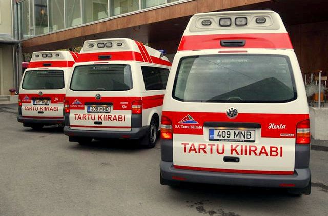
Emergency medical dispatching
To make it possible to coordinate the work of ambulance crews in real time, we decided to equip our ambulance vehicles with GPS tracking devices. The emergency medical dispatchers needed a tool that would show the location of ambulance crews and their current status (on standby, on their way to a patient, at the patient’s location, on their way to the hospital, at the hospital, in maintenance, in reserve), communicate dispatching orders to the crews and help to assess the operational speed of the crews’ response to emergency calls.
Key points of improvement
Since all ambulance crews became aware of their location in relation to other crews, they were able to team up in a synchronized manner where needed and thus save precious time in a crisis situation.
How did we analyze the crews’ response to emergency calls? The activities of an ambulance crew in response to an emergency call are recorded in a comprehensive ‘ambulance chart’, which automatically records the time when the emergency call was received by Rescue Dispatching and when the service order was issued to the crew. What we needed to do next was to measure precisely the crew’s reaction time and the time it spent to reach the destination. These were automatically recorded by the GPS. The knowledge of being closely monitored helped the crews improve their response times.
The ambulances resorted to speed driving only when it was absolutely necessary. The use of vehicles became more prudent – an additional bonus. As a result of regular scrutiny of driving practices, inexpedient speeding disappeared completely, fuel consumption dropped, the number of chance accidents caused by unnecessary speeding decreased and the reputation of emergency vehicles improved.
By measuring the service response times of ambulance crews, by visualizing the trips made, and by juxtaposing the response times with the number of emergency calls and their destinations, we were able to assess the service efficiency of our crews and determine whether maintaining an additional ambulance crew in a certain area is economically justified or not. In case you would like to learn more about this, you can read the analysis entitled „Occupancy of ambulances of Jõgeva Hospital and Tartu additional team“ (in Estonian) carried out some time ago by the nurse Andras Laugamets..
At numerous amateur sports events, marathon runs and rally races, a certain proportion of medical personnel will use motorbikes, ATVs or snowmobiles for better mobility. All such vehicles are also equipped with GPS tracking devices and are included in the ambulance monitoring system. The dispatchers know which areas are closed and how the movement of crews is synchronized, and will find a solution in cases where the local regular ambulance cannot reach an emergency due to event-related traffic restrictions.
Paramedic trainer Andras Laugamets
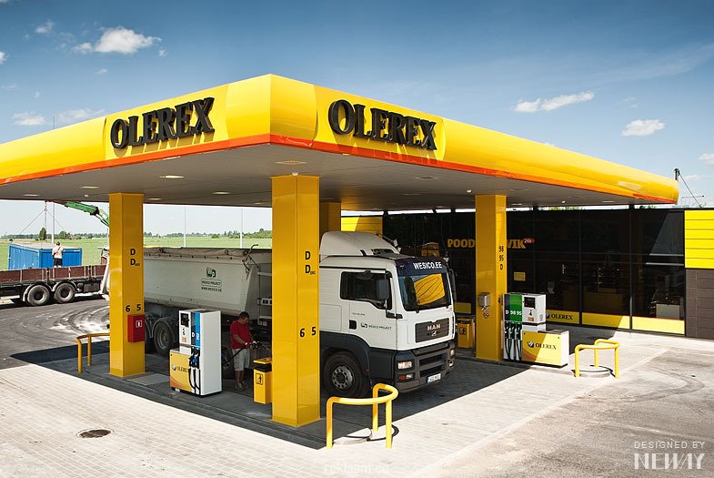
The Goal is Efficiency
Goal: Olerex strives for efficiency in all its endeavours. For this purpose, the company maps, measures and analyzes activities that, when adjusted to proceed smoothly, will help us improve our work processes and contribute to our incentive-based pay system.
Solution: We have been monitoring the geographical location and movement of vehicles for quite some time. We use existing fuel sensors to monitor fuel consumption and compare the performance of various vehicles and drivers. Using the Metrotec solution’s two-way communication feature, logistics dispatchers issue orders to drivers and receive drivers’ reports.
In cooperation with Metrotec, from time to time we analyze various work processes and, during our discussions of these analyses, have discovered new opportunities for improvement. After some pilot testing, we decided to commence monitoring the status of offloading pumps and trailers’ side hatches. Our drivers work in shifts and, if possible, the vehicles are in use on a 24/7 basis. For the identification of drivers and to keep track of their working hours, we installed RFID readers in the trucks. We also interfaced Metrotec’s system with our own accounting software.
Result: The vehicles are being operated in a coordinated manner, fuel consumption is under control and the offloading of liquid fuel is easily and conveniently monitored. Smart solutions save time!
The monitoring of the trucks’ side hatch status and the measuring of the operation of offloading pumps helps us assess the efficiency of our drivers’ work. On the basis of collected data, we can compare the performance of each driver to the average stats and reward those who are faster. Increased offloading speed has effectively cut the trucks’ idle time and improved our general hauling performance.
The use of RFID cards by drivers for clocking in and out has simplified the calculation of their salaries and the analysis of their performance. Manual transmission of information has been done away with, there are fewer errors and the accuracy of the data has increased.
Another significant improvement which considerably simplifies our work is the regular downloading of tachograph data. Previously, tachograph data had to be collected at the vehicles’ locations all over Estonia – which required considerable coordination – whereas now this is automatically done by the software. Less drudgery to keep track of and more time saved!
Interfacing Metrotec’s system with our accounting software has turned out to be very handy. A lot of the data is received automatically. This eliminates cumbersome and error-prone manual transfers between systems. Information is available in good time and helps us make well-informed decisions – which, in turn, increases the overall efficiency of the company.
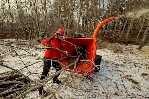
Working on side roads
Problem: Reinpaul is a company that processes, collects and sells woodchips. This requires daily management and coordination of the operation of numerous motorized vehicles of different types—trucks, minivans, front-loaders, bucket loaders, etc. The trucks deliver several loads a day at different locations and knowing where and when one needs to be was and is of crucial importance. The vehicles also often travel on side roads, making coordination even more difficult – it could not be accomplished by phone in a satisfactory manner.
Solution: Metrotec’s mechanics came to the workshop and set up the required devices. At first, the nuber of units was 10 – today, we already have 40.
Outcome:
Thanks to the two-way channel between the drivers and between the driver and the dispatch centre, communication is much more efficient. Drivers’ location is known to other drivers and dispatchers at all times, instructions can be given and orders and coordinates transmitted in real time and to any number of vehicles simultaneously.
A changeable basemap allows us to find patches of undergrowth and buildings located away from roads. Correct coordinates can instantly be transmitted to everyone by a single click of the mouse.
In addition, the service schedule of all vehicles is linked to an automatic notification system—every time a vehicle needs regular maintenance at the company’s own or at the vehicle manufacturer’s workshop, timely notification will be displayed to remind the personnel of the upcoming maintenance, guaranteeing that important maintenance appointments will not be skipped.
GPS tracking of construction equipment
Komatsu rental machines (bulldozers, crawler and wheeled excavators, mini and midi excavators, loader excavators, wheel loaders) were equipped with GPS trackers, first, for security reasons and second, to track their machine-hour usage.
“One needs to keep an eye on one’s property. Routine positioning of rental machines at the start of the day is a must like the croissant with your morning coffee. The important thing is to have all machines where they are supposed to be at the given time,” says sales manager Andrus Danilov and recalls an incident from years ago when “I called Metrotec on a Monday morning to enquire as to why one of my machines was suddenly showing up in the central Finland.” Tracking data history revealed that, essentially as soon as the machine was rented, it was loaded onto a truck, hauled to the port and then sent across the sea towards a destination somewhere in the middle of Finland. Prompt and ingenious steps were taken, resulting in the return of the stolen machine to its rightful owner.
Read the article „Staged Theft of Rented Loader Foiled by GPS Tracker“
In the case of long-term rentals, the renter will be billed monthly for the use of the machine. Often, such agreements stipulate rental payments by the number of days worked. The GPS tracking system counts both machine hours and machine days, making the billing operation simple and clear for the owner as well as the renter. The owner always knows the number of machine hours worked and the system automatically provides alerts of scheduled maintenance needs.
Additionally, the positioning system’s web interface offers the valuable option of remote activation of the vehicle’s immobilizer and allows the engine of the vehicle to be shut down. “…Quite a few times, this function has allowed us to expedite payment of rental bills. At the same time, there have been occasions when, upon the engine’s shutdown, the renter has immediately reached for the phone and called in a maintenance crew. The crew would, of course, only arrive to find that the machine is in perfect working order and requires no repairs,” chuckles Andrus Danilov.
Andrus Danilov, Sales Manager for Rental Machines

Rail Estonia Ltd., monitoring fuel consumption of locomotives on Estonian railways
In 2004-2005, the Estonian national railway company equipped their fleet of used U.S.-built locomotives with GPS tracking and fuel monitoring devices. The primary purpose of this exercise was to determine the locomotives’ actual fuel consumption. Until then, the company’s estimates were based on the fuel consumption figures from the locomotives’ previous exploitation period, which lacked an objective basis.
It is no secret that the consumption figures of that period were to a significant extent impacted by widespread fuel theft. Unaccounted fuel losses, in combination with the poor driving skills of locomotive crews, railway construction operations and speed limits gave rise to extensive fluctuations in the maximum average fuel consumption figures – ranging from 600 to 1,100 litres per 100 km – for different locomotives and over different time periods.
In order to attain an objective measurement result, uncertainties needed to be eliminated – the focus of the monitoring system was set on discovering and identifying fuel losses. The system was programmed to trigger alarms even during the movement of the locomotive if the fuel consumption level rose above the maximum average figure.
The implementation of the monitoring system was initially met with resistance—to discredit the system in the eyes of the management and to cast doubt on its quality, the devices were massively sabotaged at the beginning of the introduction phase.
Regardless, it soon became clear that the actual consumption of diesel fuel was substantially lower than the established consumption rate.
Rapid response to alarms caused the number of theft incidents to drop substantially.
By registering the run rates of the locomotives’ diesel engines and linking them to the manufacturer’s corresponding per-hour rated consumption figures, we were able to compare the actual fuel consumption to rated values. By analyzing the data and reacting to unjustified deviations, virtually all ‘unaccounted losses’ were eliminated.
To understand the causes of heightened fuel consumption, a gradient profile was prepared for all rail tracks. The profile records the length of the ascending and descending gradients and the differences in their elevation. In addition to allowing a more detailed fuel consumption analysis, the profile also made it possible to assess the drivers’ driving technique.
Based on the collected monitoring data, several reductions were made in the allowed consumption rate. In 2006, these resulted in a 15% economy in fuel expenditure, which allowed the company to recoup the investment into the tracking system in merely two months.
Tiit Paju, Deputy Chief Financial Officer
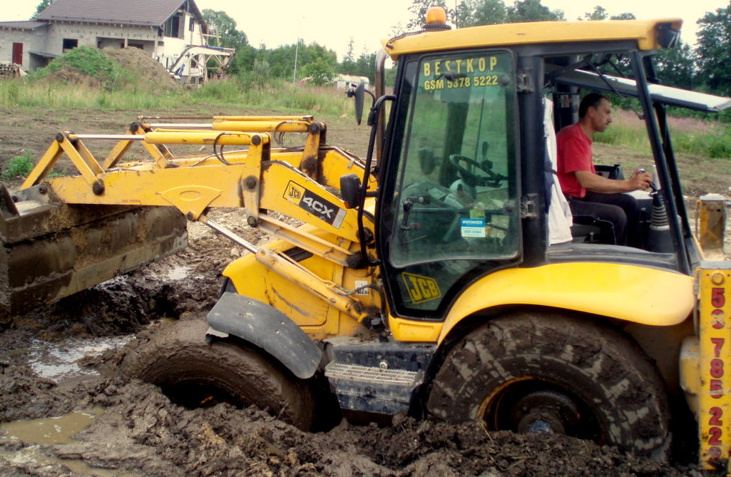
Bestkop, provider of backhoe loader services by the hour
The monitoring of the operations of backhoe loaders requires a special approach.
Goal: Bestkop needed to know how long the machines stay on the site, how long they drive to the site and how can they find the quickest route to the site. Also, machines needed to be monitored for fuel consumption and theft.
Solution: Metrotec recommended equipping the machines with the fuel level sensors it has developed. The sensors monitor fuel consumption during work operations and also trigger an alarm should a sharp drop in fuel level occur over a short span of time. Additionally, F-Track enables two-way communication between the machine’s driver and the office – this permits instructions for reaching the site to be given in real time.
