
Our services are used by 700+ companies
We have installed over 9,000 devices
Special solutions based on the clients’ needs
GPS tracking devices installed in vehicles can now do far more than simply display a route on a map. What are the latest trends?
“Our customers now include more technicians and service vehicles than long-haul trucks,” says Navirec Sales Manager Jürgen Levandi, summarising the direction GPS tracking has taken in recent years. “Most of our work in recent years has involved customised solutions, because there is no single, universal solution that works for everyone,” adds Metrotec CEO Aare Mukk. Competition in the vehicle GPS tracking market is certainly fierce, but both Navirec and Metrotec are among the local market leaders, well placed to provide an informed overview of the technology currently available.
Of course, solutions designed for trucks have not disappeared. In this sector, the main requirements are tracking vehicle locations and transmitting tachograph data to the computer of the person responsible for monitoring it. These systems also allow customers to receive timely updates on arrival times and help operators check compliance with legislation governing drivers’ working and rest periods. Looking beyond trucking to postal services, the police and rescue services, construction and agriculture gives an idea of just how varied the uses of GPS solutions have become.
How does it work?
A GPS tracking device contains a SIM card. Data travels from the device to a server over the GSM network and then reaches the customer via the internet. This system has been in use for years, supporting navigation and giving employers information about vehicle movements: the route, speed, and time are displayed on a map. The basic principle is very simple.
According to Mukk and Levandi, the biggest advance in recent years has been connecting GPS devices to vehicles’ electronic control systems through the CAN bus. This provides access to mileage, engine fluid temperatures, fuel level, actual fuel consumption, and a range of other readings.
“For example, we can obtain data from the vehicle’s fuel injection system showing how much fuel the engine has actually burned. We can then use this to produce a report on actual fuel consumption,” explains Levandi. He adds that the police, for example, also use this data to determine when vehicles in their large fleet are due for servicing.
A tracking device can also be connected to sensors to establish a vehicle’s actual operating time and workload. These can show, for example, whether a snowplough blade is lowered or raised, whether a grit spreader is running, or whether particular pumps on a vehicle are operating. The collected data is then compiled into a report showing when and where the work was carried out.
“I can give you an example from a waste collection company,” says Mukk. “The company was having considerable difficulty proving whether a particular container had been emptied.
“To address this, we connected the refuse truck’s lifting mechanism and bin-lifting comb or winch to the device’s inputs. This made it clear whether the lifting mechanism and bin-lifting comb had been activated at a particular location and time. It was then also possible to see on the map where and when the lifting mechanisms had operated.”
Levandi gives another example from agriculture, where a GPS device can help determine whether a tractor driver has ploughed an entire field properly: “Customers have had problems with very large fields where the middle has been left unploughed.
“No one is going to drive out into the field to check whether the work has been done. But with a GPS-equipped tractor, you can replay its movements on the map and clearly see whether and how it has covered the field.”
The field map also records when the tractor entered and left the field, showing how long it actually worked there.

In addition to standard location and fuel monitoring, it is becoming increasingly important to track the operational efficiency of different machines. By analyzing this data, production and transport processes can be improved and made more efficient, transparent, and reliable – for the company itself, its employees, and its customers.
Read more
With a heavy equipment fleet, the two largest expense items are fuel costs and depreciation due to wear and tear of the equipment. How can these expenses be kept in check most effectively? But of course, the best answer can be found in GPS tracking. Its uses can be much wider-reaching and varied than mere checking whether a vehicle’s engine is currently running or turned off. Unobtrusively and subtly, GPS tracking keeps an eye on the fleet’s main expenses and triggers a notification when and where needed.
Read more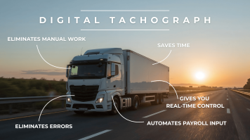
Most transport companies know that digital tachograph data can be read remotely. This is no longer a new or unfamiliar topic. But here’s the important question: have you really thought through what this means for your company? Are you using the digital tachograph to its full potential?
Read more